Continued from Introduction To Maps:
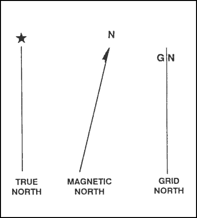
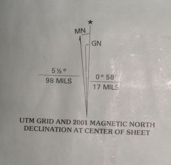
The Grid-Magnetic angle (or G-M angle) value is the difference between grid north and magnetic north. It is an arc, measured in degrees between the grid north and magnetic north lines. This value is measured in fractions of degrees, with mil equivalents shown to the nearest 10 mils. The G-M angle is important to land navigation because azimuths between map and ground should be adjusted to compensate for this difference. If not, you may be off by hundreds of meters before you get to where you are going. We will get more in depth on this on this in a future article.
Terrain features of a map can be difficult to understand when looking at it from a two-dimensional perspective. The best way to describe the terrain features indicated on topographical maps is to approach it the way I was taught. Features were broken down into five major and three minor terrain features.
The five major terrain features are: Hill, Ridge, Valley, Saddle, and Depression.
The three minor terrain features are: Draw, Spur and Cliff.
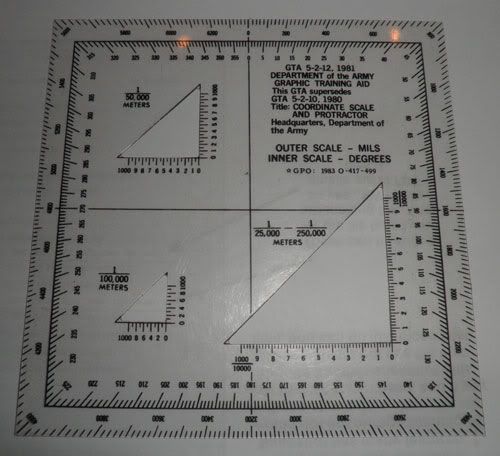
The best visual representation for these features is to get your map and compare the feature on the map to the actual land mass. For now, let’s look at some army training aids.
Five major terrain features
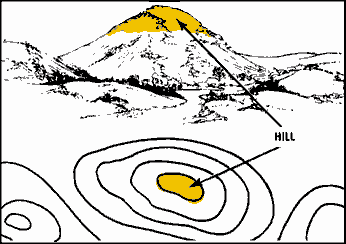
Hill: A hill represents a point of high ground with sloping features going downward. You can also observe elevation markings on the contour lines indicating the hills sloping nature.
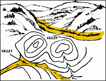
Valley– A valley is a semi-flat piece of ground bordered on the sides by higher ground. A valley may contain a stream. The contour lines indicating a valley are U-shaped and sometimes will parallel a stream.
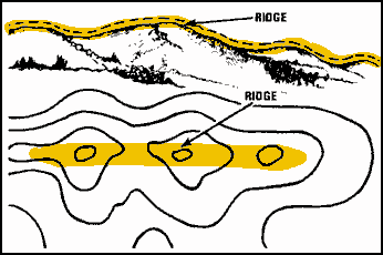
Ridge- A ridge is a sloping line of high ground. Contour lines forming a ridge tend to be U or V-shaped. The closed end of the contour line points away from high ground. I like to remember this when trying to determine if I am looking at a ridge or valley… “valley toward,” “ridge away.” That means the U or V is going toward the high ground on a valley and away from high ground on a ridge.
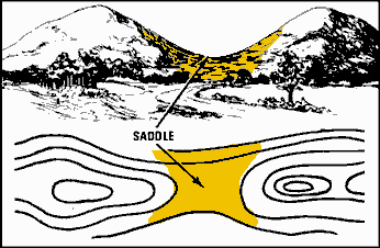
Saddle. A saddle is a dip between two areas of higher ground. A saddle is typically found between two hilltops. It can also be a dip along a ridge line. If you are standing in a saddle, you will see high ground in two opposite directions and lower ground in the other two directions.
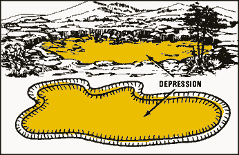
Depression. A depression is a low point in the ground. A good example of a depression would be a quarry. I depression is pretty much a hole in the ground. On your map, a depression will show closed contour lines with tick marks pointing toward low ground.
Three minor terrain features
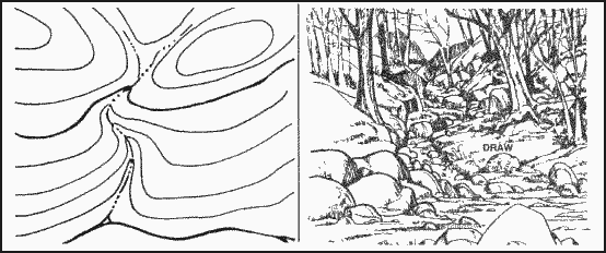
Draw. A draw is kind of like a small version of a valley. The exception being that in a draw, there is little or no level ground. You will likely find the draw a difficult feature to traverse. If you are standing in a draw, the ground slopes upward in three directions and downward in the other direction. A draw could be considered as the initial formation of a valley. The contour lines depicting a draw are U-shaped or V-shaped, pointing toward high ground.
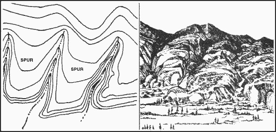
Spur. A spur is a short, downward sloping line of higher ground. You will typically find a draw formation protruding from the side of a ridge line. You may also find two parallel streams flowing down the side of a ridge. These streams will often form the spur. The ground sloped down in three directions.
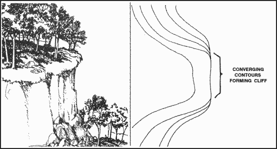
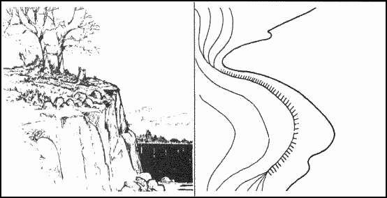
Cliff. A cliff is self explanatory. I am sure we all know one when we see it. When viewed on a topographical map, the contour lines will come together into one contour line; this last contour line has tick marks pointing toward low ground. Cliffs are also shown by contour lines very close together and, in some instances, touching each other. Remember each of these contour lines represent an elevation. The closer the lines are together, the more dramatic the slope.
We can go on for hours on the intricacies of maps and map reading. While writing this article, a flood of information started coming back to me from the old days. I have only touched on a very lengthy subject. If you are new to land navigation and want to know more, I would suggest you start by purchasing a USGS map of a location near you. You can pick them up at nearly all camping and hiking stores. They will also sell some of the tools needed in conjunction with your new map.
Tools for land navigation
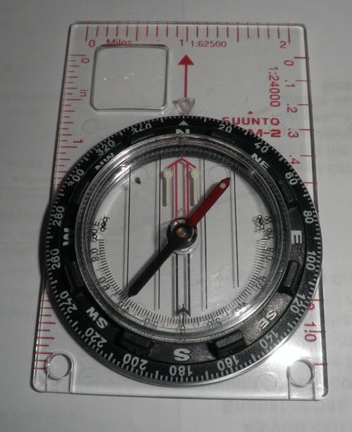
A good compass should have at least:
- A clear base plate- To see underneath the compass.
- A rotating bezel, marked with 360 degrees in 2 degree increments.
- Meridian lines- For map use.
- Declination Adjustment and arrow- to correct for the difference between magnetic and true north
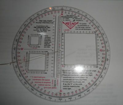
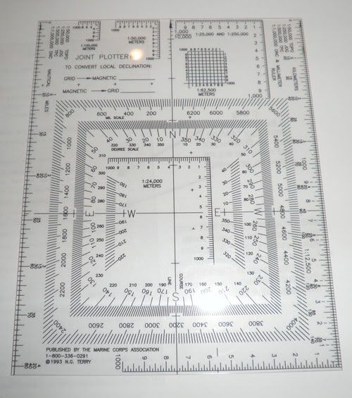
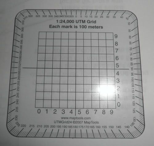
A protractor – UTM ruler:
- Your protractor will need to work with 1:24,000 , 1:25,000 and 1:50,000 scale maps
- It should also include a 360 degree compass rose for computing direction.
- The cost is usually less than five dollars, so buying an extra is advisable.
If you have or plan to purchase the army protractor keep in mind, it will only work with military scale maps. 1:100,000 – 1:50,000 – 1:25,000. Your USGS maps will have a different scale and coordinate scale part of the protractor will not work. The military protractor is known as GTA 5-2-12.
This concludes the first article in our series. I must add that some of the methods and tools described are simply my way of doing business. You may have or develop your own tools and tricks. That is what makes land navigation so exciting. If your way works, do it and be proud. In fact, if you have a better way of doing something, share it with the rest of us. These skills can save you life in an emergency. Keep your GPS handy, but know how to get by without it.
Technology is a wonderful tool and it gives us so much convenience and efficiency, but we can also become too dependant on it. In writing this article, evidence of our fast food society is in the very words I type. Technology allowed me to write this article without once consulting a dictionary or thesaurus. Believe me, my spelling and grammar have suffered from not picking up that dictionary.
Spell check is the devil.
Please check back for the next Find Your Way series of articles where learn how to establish grid coordinates and convert an azimuth.
Thanks and see you again soon,
H-Minus


